Have you ever looked down from a tall place and noticed how roads, trees, buildings, and ponds all fit together? A map helps us see a place like that. It is a smaller representation of a real place. Maps help us find where things are and talk about places clearly.
A map is a drawing or picture of a place seen from above. It can show a classroom, a playground, a park, or a neighborhood. A map does not show every tiny thing. It shows the important things we want to notice.
Maps help people answer questions such as: Where is the school? Where is the pond? Which way is the road? Where are the trees? When we make a simple map, we choose the features we want to show and place them in the right spots.
Natural features are parts of Earth that are not made by people, such as rivers, hills, trees, rocks, and lakes.
Human features are things people build or make, such as roads, houses, bridges, schools, and playgrounds.
When we learn about places, it is important to notice both kinds of features. A park may have grass, trees, and a stream, but it may also have a path, a bench, and a playground.
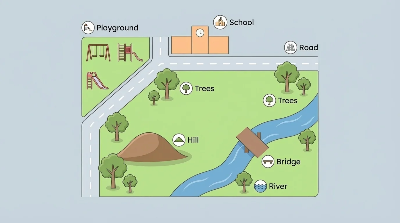
A simple map can show both natural features and human features together, as [Figure 1] shows. This helps us understand what a place is like. We can see what nature is there and what people have added.
Natural features include things like a river, a hill, a tree, or a pond. These are part of the land or water. Human features include things like a road, a house, a school, or a bridge. These are made by people.
Think about a playground near a park. The grass and trees are natural features. The swings and slide are human features. A map that shows both gives us a fuller picture of the place.
Sometimes one place has many features close together. A pond may be beside a walking path. A school may be near trees and a field. On a map, we put each feature where it belongs so the map matches the real place.
Some maps show very big places, like countries, and some show very small places, like one room. Even a small map still helps us understand where things are.
Looking carefully at a place is an important geography skill. It helps us describe spaces and notice how people and nature share the same area.
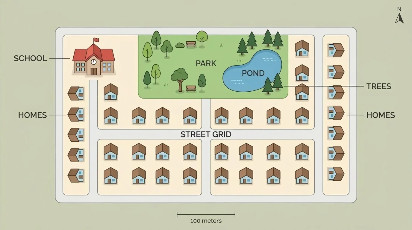
Simple maps have important parts, and [Figure 2] illustrates them clearly. These parts help the reader know what the map shows and how to understand the symbols.
One part is the title. The title tells what place the map is about, such as Our Classroom or Map of the Park.
Another part is the symbol. A symbol is a small picture or mark that stands for something real. A blue shape can stand for water. A green tree shape can stand for a tree. A black line can stand for a road.
Maps also use a key, sometimes called a legend. The key explains what each symbol means. If a map has a tiny swing-set picture, the key tells us that symbol means playground.
Direction words are also helpful. North, south, east, and west tell where things are. If the pond is north of the school, the pond is above the school on many simple maps.
A map can also have labels. Labels are words that name places, like School, Pond, or Main Road. Labels make a map easier to read.
| Map Part | What It Does |
|---|---|
| Title | Tells the name of the place on the map |
| Symbols | Show real things with small pictures or marks |
| Key | Explains what the symbols mean |
| Labels | Name places on the map |
| Directions | Help us know where things are |
Table 1. Important parts of a simple map and what each part does.
Later, when you read another map, the same parts help you understand it. The key in [Figure 2] makes the symbols easy to read, just as keys do on many real maps.
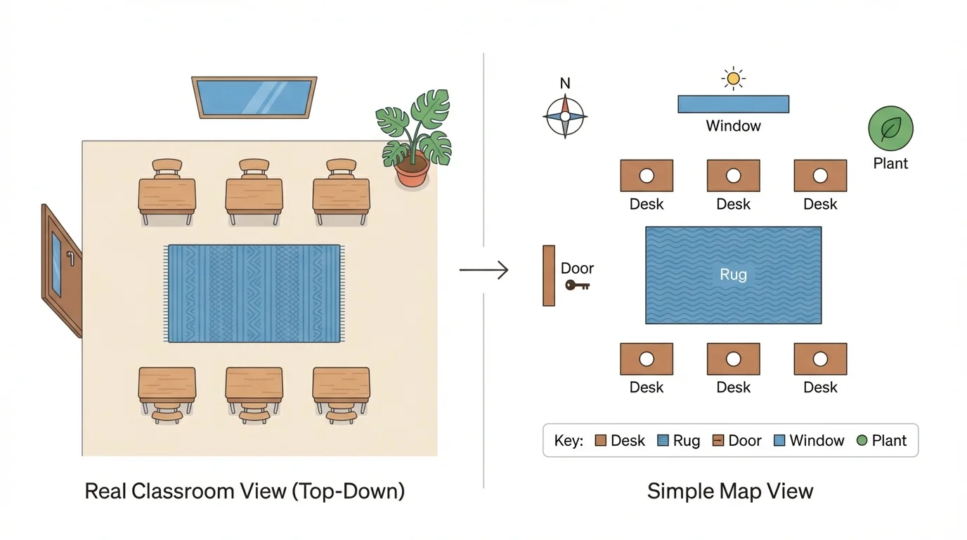
You can turn a real place into a map by following a few careful steps, as [Figure 3] illustrates. A simple map should be clear, neat, and easy to read.
First, choose a place. It might be your classroom, the playground, the school yard, or a park.
Next, look for important features. Ask: What natural features are here? What human features are here? You might notice trees, grass, and a small hill. You might also notice a path, a fence, and a building.
Then, draw the place from above. Make simple shapes. A rectangle can be a building. A wavy blue shape can be a stream. A line can be a road or path.
After that, add symbols and labels. Put the features in the right places. If the pond is beside the trees, show it beside the trees on the map.
Last, add a title and a key. If needed, add direction words or a compass rose. This helps other people understand your map.
Example: A map of a schoolyard
Step 1: Choose the place.
The place is the schoolyard.
Step 2: Notice the features.
Natural features: grass, trees. Human features: school building, sidewalk, playground.
Step 3: Draw simple shapes.
A large rectangle shows the school. Lines show the sidewalk. Small tree symbols show the trees.
Step 4: Add labels and a key.
The map is labeled School, Playground, and Trees. The key explains the symbols.
Good maps do not need lots of tiny details. They need clear features in the right places. The step-by-step picture in [Figure 3] shows how a real space becomes a simple map.
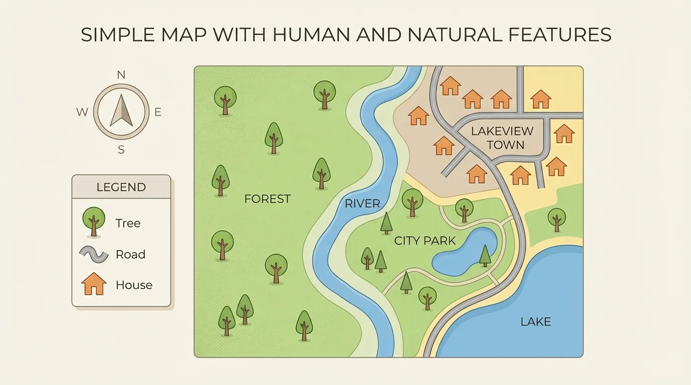
A neighborhood is a good place to map because it often has both natural and human features, as [Figure 4] shows. Houses, streets, and schools are human features. Trees, ponds, and grassy areas are natural features.
On a neighborhood map, a student might show a street running past several houses. Near the street there may be a school and a park. In the park there may be trees and a pond. This one map tells us a lot about the area.
A park map is another good example. It may show a pond, hill, and trees along with a bridge, path, and playground. When both kinds of features are on the same map, we can describe the place better.
We can use location words too. The pond may be east of the playground. The school may be south of the park. These words help us explain where features are.
Maps help us describe places and spaces. Geography is about noticing where things are and how places are organized. When we make a map, we are showing location, direction, and the features that make a place special.
By looking at a simple map, we can tell how people use a place. Roads help people travel. Bridges help people cross water. Trees give shade and beauty. Ponds and hills change how the land looks and feels.
People use maps every day. A family may use a map to find a park. A teacher may use a map of the school to show where the library is. Workers may use maps to plan roads and buildings.
Maps also help us stay safe and organized. If we know where the road, bridge, or pond is, we can move around a place more easily. The neighborhood map in [Figure 4] shows how features fit together in one space.
Even when maps are simple, they carry important information. They help us answer questions about where things are, what is nearby, and whether a feature is natural or human-made.
When making a simple map, it is important to be careful. Put features in the correct places. If the playground is beside the school, do not draw it across the street unless that is where it really is.
Use neat symbols. Make labels easy to read. Keep the map simple so others can understand it quickly. A clear map is more helpful than a messy one.
You already know that places have location and direction. A map uses those ideas to show where things are in space.
As you read and create maps, remember to look for both nature and things made by people. That is how maps help us understand the world around us.