Have you ever looked at Earth from far away in a picture? Much of our planet looks blue. That is because Earth has so much water. But Earth also has land, where people build homes, roads, schools, and parks. We can use special tools to help us see where land and water are. Two important tools are maps and globes.
A map is a picture of a place from above. It is flat. A map can show a bedroom, a town, a state, or even the whole world. A globe is a round model of Earth. It has the shape of our planet.
Maps and globes help us learn about geography. Geography is the study of places and spaces. It helps us talk about where things are. When we look at a map or globe, one big job is to tell what parts are land and what parts are water.
Land is the solid part of Earth. People, animals, trees, and buildings can be on land.
Water is the part of Earth that is in oceans, seas, lakes, rivers, and ponds.
Land and water do not look the same on a map or globe. They often have different colors, different shapes, and different sizes. Learning to notice these clues helps us read maps and globes better.
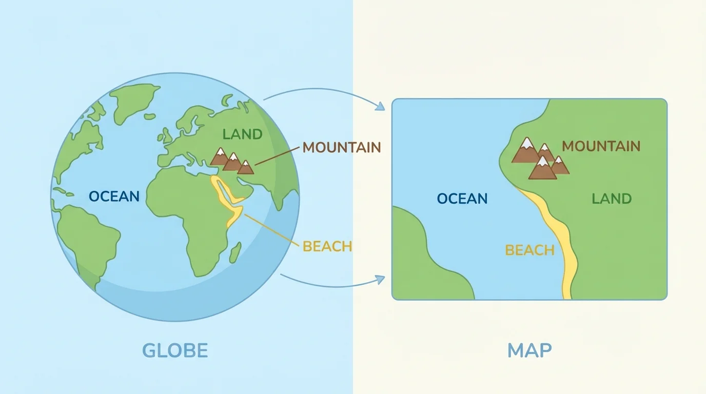
[Figure 1] Land can be big or small. A very large area of land is called a continent. Continents are huge pieces of land. Smaller pieces of land can be islands, hills, plains, or mountains. Some land is flat, and some land is high or rocky.
Water can also be big or small. The largest bodies of water are called oceans. Oceans are very big and salty. A river is water that moves in a long path. A lake is water with land all around it. A pond is like a small lake.
An island is land with water all around it. This is a very important clue: if you see land surrounded by blue water on a map or globe, it may be an island.
Earth has more water than land. That is why our planet is sometimes called the "blue planet."
People live on land, but they also use water for travel, fishing, and recreation. Boats move on rivers, lakes, and oceans. Beaches are places where land meets water. On many maps, it is easy to spot where land stops and water begins.
One helpful clue is color. On many maps and globes, blue shows water. Land is often shown in green, brown, tan, or yellow. Green may show grassy land or forests. Brown may show mountains or higher land.
Shape is another clue. Water areas can spread out wide like oceans or curve like lakes. Rivers often look like long, winding lines. Land areas may look like large shapes, long coastlines, or small islands in the water.
Some maps use labels too. A map may say "Atlantic Ocean," "Mississippi River," or "Lake Michigan." The label helps us know the name of the water. Other labels may name land, such as "Africa" or "North America."
If a map has a symbol, it uses a small picture or mark to stand for something. A map key can help explain these symbols. Even when symbols are used, water is still often blue, and land is still shown in other colors.
[Figure 2] A globe helps us see Earth as a round planet. On a globe, the oceans connect around the world. The continents are surrounded by these large bodies of water.
Because a globe is round, it helps us understand that Earth is not flat. We can turn a globe and see different places. One side may show a large ocean. Another side may show several continents. This makes it easier to see how much of Earth is covered by water.
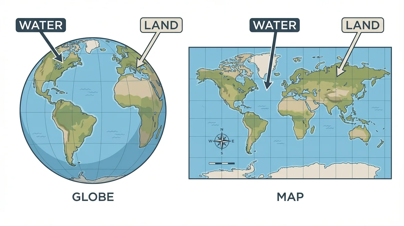
On a globe, you can find both very large and very small places. You may notice a giant ocean first because of the large blue space. Then you may spot a continent, a country, or an island. A globe helps us see that land is broken into different parts across Earth.
When students use a globe, they often begin by pointing to blue areas for water and other colors for land. This same idea helps students later when they study where people live, where animals live, and how people travel from one place to another.
A map is flat, but it can still show land and water clearly. A world map may show all the continents and oceans. A state map may show rivers and lakes. A neighborhood map may show a pond, a park, roads, and houses.
Maps are useful because they can show places close up. If you want to find a river in your town or a lake near a park, a map can help. You can use the color blue to look for water and other colors to look for land.
Reading a simple map
A classroom map shows a green park, a blue pond, and gray roads.
Step 1: Look for the blue part.
The blue pond is water.
Step 2: Look for the green part.
The green park is land.
Step 3: Decide what is around each place.
If the pond is inside the park, the water is surrounded by land.
This tells us the pond is a small body of water on land.
Sometimes a map does not use the exact same colors, but the map key explains what each color means. Good map readers always look for clues: color, shape, labels, and symbols.
You already know many places where land and water are easy to tell apart. A playground is on land. A puddle after rain is water. A beach has both land and water. A bridge goes over water so people can move from one piece of land to another.
If your family visits a lake, you stand on land at the edge and look at the water. If you visit the ocean, you may see sand on one side and water on the other. Maps help us find these places before we go there.
You may already know direction words such as left, right, near, and far. These words help you describe where land and water are on a map.
Geography helps people every day. Pilots, boat captains, hikers, and families all use maps. They need to know where the land is safe to walk or drive and where the water is for crossing, fishing, or swimming.
[Figure 3] A map and a globe both show Earth. They both use the same basic idea: blue usually shows water, and other colors usually show land. The difference is that a map is flat and a globe is round.
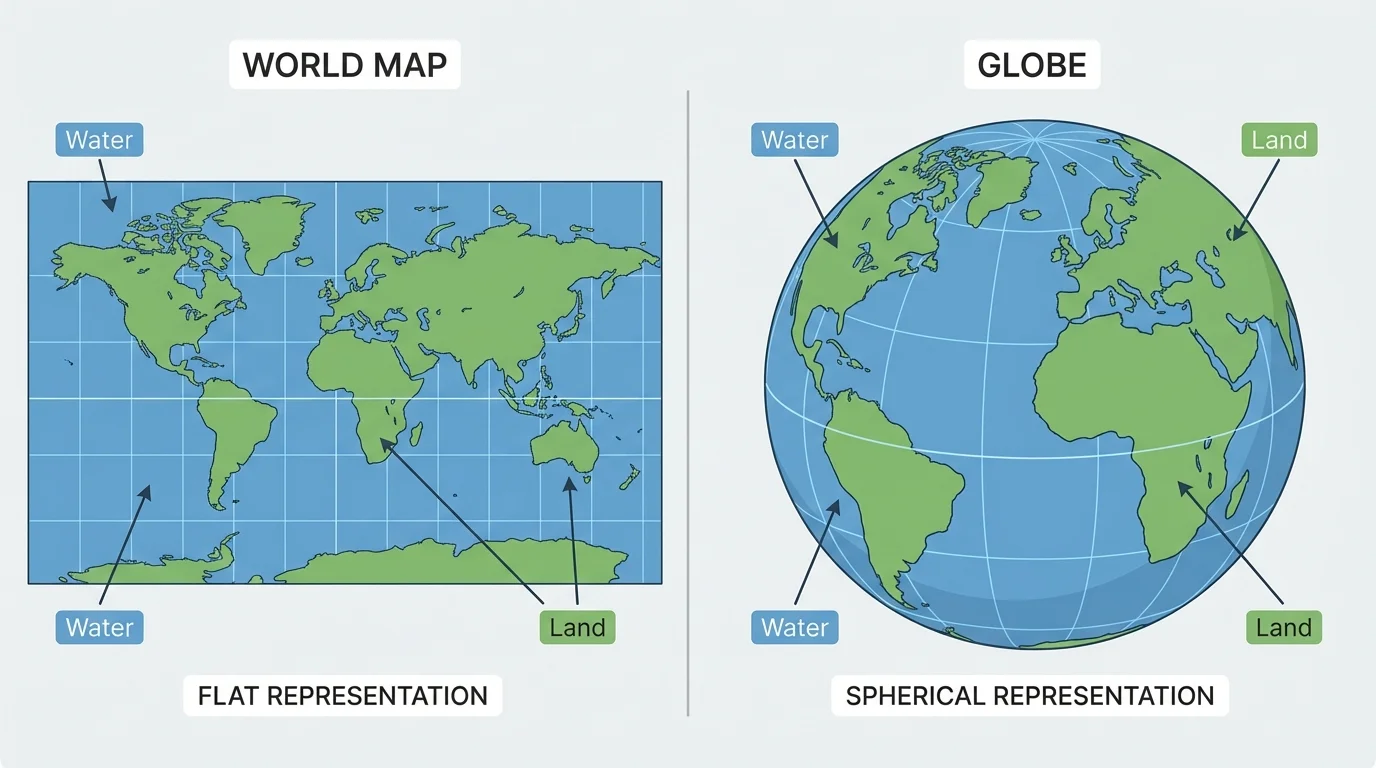
A globe is great for seeing the whole Earth as one round planet. A map is great for showing a place in more detail. Both tools help us answer the same question: "Is this place land or water?"
When you compare them, you may notice the same continents and oceans on both. For example, a large blue ocean on the globe matches a large blue ocean on the map. This is the same idea we saw earlier, where the globe makes the water around Earth easy to notice.
Geography words help us describe where places are. We can say a river is near a town. We can say an island is in the ocean. We can say the playground is left of the pond on a map.
Older students also use direction words like north, south, east, and west. For now, it is enough to begin with simple place words such as near, far, above, below, left, and right. These words help you talk clearly about land and water.
When you look at a map or globe, ask yourself: What color is it? What shape is it? Is it a wide blue area like an ocean, a thin blue line like a river, or a large colored shape like a continent? These questions help you become a strong map reader.
As you keep practicing, you will notice that land and water are not just colors on a page. They are real places where people live, travel, work, and play. Knowing the difference helps you understand your world better.