Have you ever seen a ball painted like Earth or a paper map folded in a car? Both of those help us learn about our world. Earth is very big, so people use special tools to show it in smaller ways. Two important tools are maps and globes. They both help us find places, but they are not the same.
Earth is roughly spherical. We live on the land and near the water on Earth, but we cannot step back and see the whole planet at one time. That is why people make models and drawings of Earth. These tools help us talk about where places are and what spaces look like.
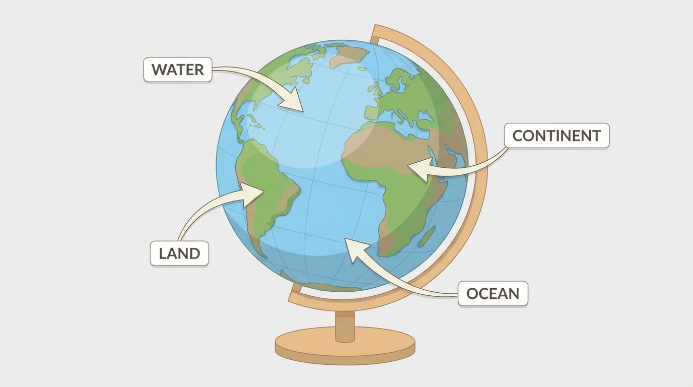
Earth has continents, which are very large areas of land, and oceans, which are very large bodies of water. Maps and globes can show both land and water.
Globe means a round model of Earth. Map means a flat drawing of all or part of Earth.
When we use these tools, we are studying places and spaces in geography. [Figure 1] helps us begin to see how Earth can be shown as a round model. A place can be your home, your school, or a country far away. A space is the area around it.
A globe is a round model of Earth. Because a globe is round, it is shaped more like the real Earth than a flat picture is.
On a globe, the blue parts show water, and other colors show land. A globe can show the whole world at one time. You can turn it to see different places. If you spin a globe, you can look at one side and then the other side.
A globe helps us notice that Earth is not flat. It also helps us see that some places are far apart. If one place is on one side of the globe and another place is on the other side, they are very far away.
Globes are useful for seeing the shape of Earth. They help show the sizes of oceans and continents in a way that matches Earth's round shape. Later, when we compare tools again, [Figure 1] reminds us that a globe curves like the planet.
Some globes show countries and oceans, and some show stars and planets. A globe is a model, and models help us study things that are too big to hold.
A globe is useful for showing the whole planet, but it also has limits. It is harder to carry than a small piece of paper, and it cannot show tiny details of one street or one classroom very well.
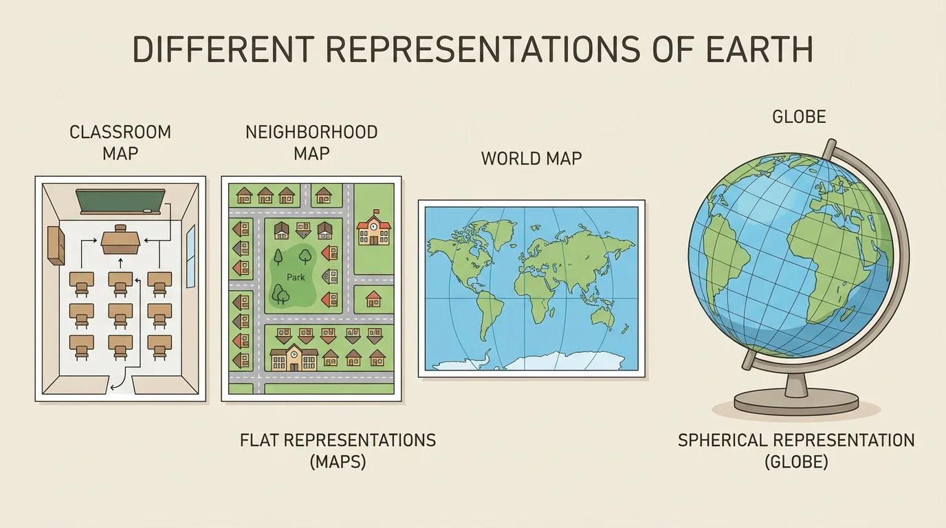
A map is a flat drawing of a place. A map can show the whole Earth, one country, one town, one park, or even one room.
Maps are easy to fold, hang on a wall, or put in a book. A classroom map might show where the door, desks, and reading corner are. A town map might show streets and parks. A world map might show continents and oceans.
Because maps are flat, they are easy to look at all at once. They are also easy to carry. That is one reason many people use maps when they travel or when they want to give directions.
Maps often use symbols. A symbol is a picture or mark that stands for something else. For example, a star might show a capital city, and a blue line might show a river.
Maps can show small or large places
One special thing about maps is that they can show a smaller or larger area. A map can show a tiny space, like a playground, or a huge space, like the world. This makes maps very useful for many jobs and many kinds of travel.
[Figure 2] helps us see that maps do not always show the same size of place. When you look at a map of your school, you can find the library or the playground. When you look at a map of the world, you can find continents and oceans.
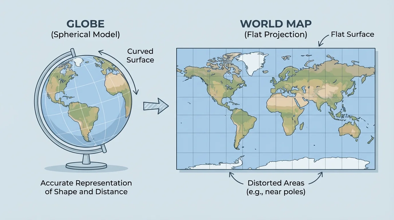
[Figure 3] helps us compare the two tools. Maps and globes both represent Earth, but they do it in different ways. A globe is round. A map is flat. A globe shows Earth with a spherical shape. A map shows Earth on a flat surface.
Both tools are helpful, but each one is best for different jobs. A globe is great for showing the whole world and its round shape. A map is great for showing details and for being easy to carry.
| Tool | What it is like | What it does well |
|---|---|---|
| Globe | Round model | Shows Earth's shape and the whole world |
| Map | Flat drawing | Shows details and is easy to carry |
Table 1. A simple comparison of maps and globes.
A world map can show the whole Earth on flat paper, but flattening a round world can make some places look stretched or changed. It is important to know that a map and a globe are different representations of the same Earth.
If you want to see the planet's round shape, a globe is the better tool. If you want to find your street or your school, a map is usually the better tool. That is why people learn to use both.
Example: Choosing the best tool
Step 1: Think about the question.
If the question is, "What does the whole Earth look like?" we need a tool for the whole planet.
Step 2: Match the tool to the job.
A globe works best because it is round like Earth.
Step 3: Try a different question.
If the question is, "Where is the playground in our school?" a map works best because it can show small details.
The best tool depends on what place you want to study.
When we look back at [Figure 3], we can clearly see the biggest difference: one representation is curved and one is flat.
Geography uses words that help us describe places and spaces. We may talk about land, water, continent, ocean, road, river, city, and school. Maps and globes help us use these words correctly.
A globe can help us find a continent or an ocean. A map can help us find a classroom, a neighborhood, or a state. Both tools help us answer questions such as "Where is it?" and "What is near it?"
You already know that places can be near or far. Maps and globes help you see near and far in a picture or model.
People also use relative position words on maps, such as up, down, left, and right, and later they learn the cardinal directions north, south, east, and west. These words help us describe location. A map of a park might show the pond near the trees. A globe might show that one ocean is between two continents.
People use maps and globes in real life every day. Teachers use them in school. Families use maps to travel. Weather forecasters use maps to show where rain or snow is moving. Pilots and sailors also use maps and globes to understand where they are going.
If a child wants to see where Nebraska is in the United States, a map can help. If that child wants to see where the United States is on the whole Earth, a globe can help. The two tools work together.
That is the big idea: maps and globes are both representations of Earth. They show the same world, but they show it in different forms. One is flat, and one is round. Learning to use both helps us understand our planet better.