Have you ever looked for your house, your school, or a faraway place on Earth? People use special geography tools to help them see where places are. Two important tools are maps and globes. They both help us show places where people live, but they are not the same.
Maps and globes are tools that help us see places. They can show where homes, roads, towns, countries, oceans, and other places are. A map is flat. A globe is round.
A map is a flat representation of a place.
A globe is a round model of Earth.
People use these tools because Earth is very big. We cannot hold the whole real Earth in our hands, but we can look at a map or a globe to learn about it.
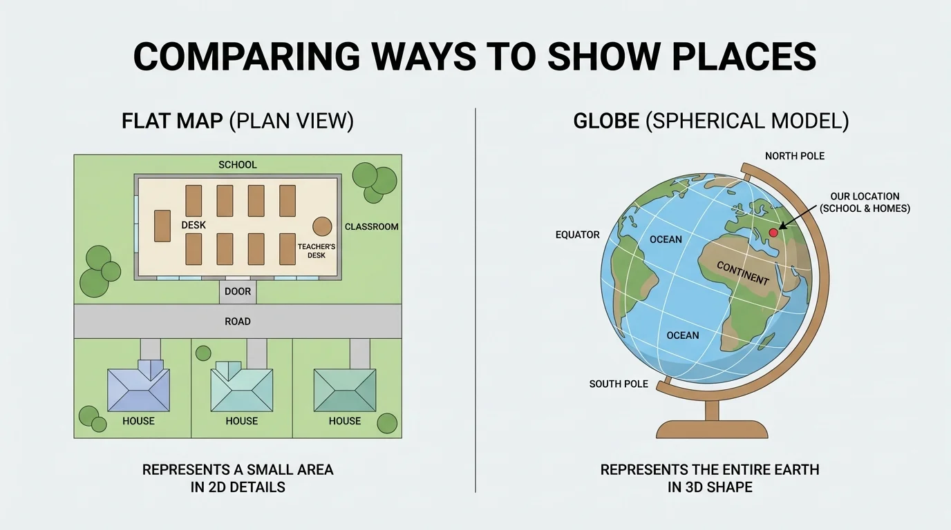
[Figure 1] A map is a flat picture of a place. A map can show a very small place, like a classroom, or a bigger place, like a town. Some maps show roads. Some maps show parks. Some maps show where people live.
For example, a map can show your street, your school, and the playground. It helps people know where to go. A map can also show a state or a whole country.
Maps are helpful because they are easy to carry and easy to look at on paper or on a screen. A phone map helps families drive to a new place. A wall map helps children see where cities and countries are.
Some maps show very tiny places, like one zoo, and some maps show very big places, like the whole world.
When a map shows where houses, buildings, and streets are, it helps us understand where people live and move from place to place.
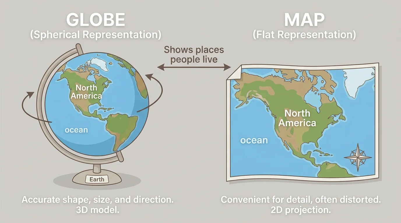
[Figure 2] A globe is a round model of Earth. Earth is round, so a globe has a shape more like the real Earth than a flat map does.
On a globe, we can see land and water. The blue parts are oceans, and the land is where people live. A globe can show all the continents and all the oceans together.
A globe helps us notice that Earth is one big world. People live in many places on the land: in neighborhoods, cities, countries, and continents. A globe helps us see that these places are all part of the same planet.
Why a globe is special
A globe shows the whole Earth in a round shape. Because Earth is round, a globe helps us see the world more like it really is. It helps us understand that if we travel far enough across the ocean or land, we are still on the same Earth.
Globes are very good for looking at the whole world, but they do not usually show small details like one street or one school.
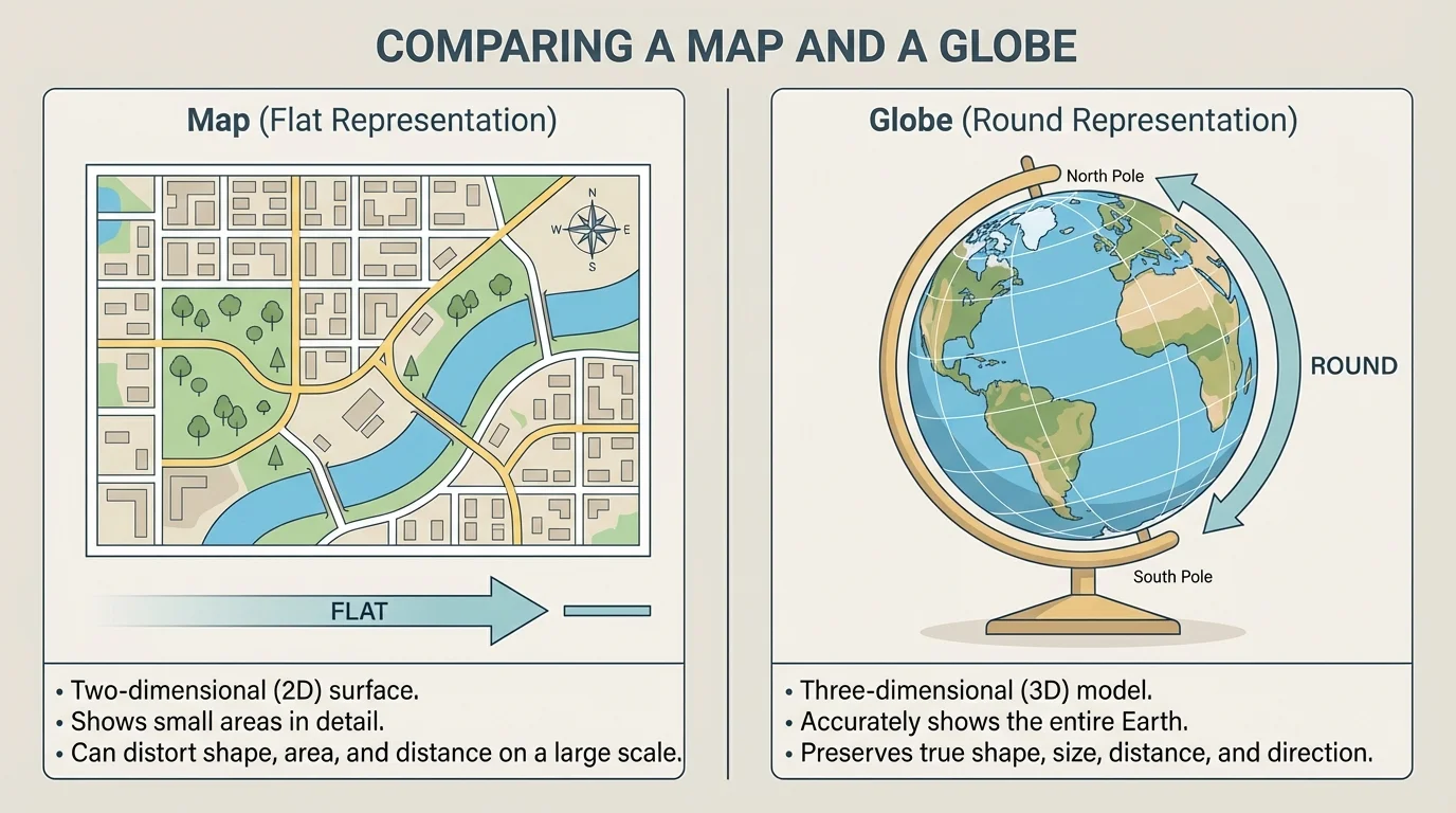
[Figure 3] Maps and globes both show places, but they do it in different ways. A map is flat. A globe is round. A map can show a small place or a big place. A globe shows the whole Earth.
| Tool | What it looks like | What it can show |
|---|---|---|
| Map | Flat | A room, a neighborhood, a town, a state, or the world |
| Globe | Round | The whole Earth |
Table 1. A simple comparison of maps and globes.
A map is often better when we want to find a road, a park, or a house. A globe is often better when we want to see where one country is compared to another country or where the oceans are around the world.
We can say it like this: a map helps us zoom in on places, and a globe helps us look at the whole planet. When we looked at the round Earth on the globe in [Figure 2], we saw why a globe is useful for the whole world. When we looked at the flat picture in [Figure 1], we saw why a map is useful for smaller places.
Example: Which tool would you use?
Step 1: If you want to find your classroom, use a map.
Step 2: If you want to see all of Earth, use a globe.
Step 3: If you want to find a country far away, a globe can help you see where it is in the world.
Both tools are helpful. The best tool depends on what place you want to see.
Even though maps and globes are different, both are useful because they help people understand space, distance, and location in simple ways.
Families, teachers, travelers, and children use maps and globes every day. A family may use a map on a phone to drive to a store. A teacher may use a globe to show where another country is. A child may use a classroom map to find the reading corner or the door.
These tools help answer questions like: Where do I live? Where is my school? Where is our town? Where is another country? Where is the ocean? Geography tools help people learn about their world.
People live in many kinds of places. They may live in houses, apartments, towns, cities, or rural areas. Maps and globes help show where those places are.
Maps can also show human features such as roads and buildings. They can also show natural features, such as rivers, mountains, and oceans. Globes show the big picture of Earth, including the large land areas called continents.
People live in homes. Homes are in neighborhoods. Neighborhoods are in towns or cities. Towns and cities are in states. States are in countries. Countries are on continents. All of these places are on Earth.
A map can show where a home or school is in a neighborhood. A globe can show where a country is on Earth. That means both tools help us learn where people live, just at different sizes.
If we want to find one nearby place, a map is very helpful. If we want to understand where our country is in the world, a globe is very helpful. Together, maps and globes help us see places close to us and places far away.