Have you ever wondered how people know where the park is, how to get to school, or where faraway countries are? People use special tools to learn about places on Earth. These tools help us look at places, talk about places, and find places.
Geographic tools are things we use to show where places are. They help us understand the world around us. Some important tools are globes, maps, and GPS.
Place means a location, such as your home, a playground, a city, or a country. Geographic tools are tools that help us see, find, and describe places.
We can use these tools to say where something is. We can say a place is near our house, far from our town, next to a road, or across the water. These tools help us talk clearly about places and locations.
[Figure 1] A globe is a round model of Earth. It helps us remember that Earth is round, and it shows land and water. On a globe, the blue parts are oceans and the other colors show land.
A globe can show very big places, such as continents and oceans. It can help us find where our country is and where other countries are. A globe is helpful when we want to look at the whole Earth.
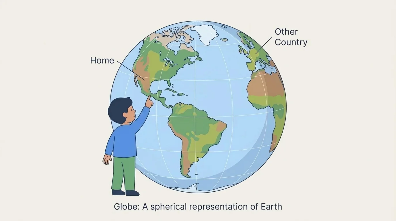
Because a globe is round, it looks more like Earth than a flat picture does. But a globe can be hard to carry around. It is good for seeing the whole world, not for showing every little street.
Some globes can spin. When they turn, we can look at many different parts of Earth without moving from our seat.
When we look again at [Figure 1], we can see that a globe helps us talk about places that are very far apart, like your town and another country across an ocean.
[Figure 2] A map is a flat picture of a place. It can show a bedroom, a school, a neighborhood, a state, or the whole world. Maps help us see where things are on a flat page or screen.
Maps can show roads, rivers, parks, schools, and homes. Some maps use colors, lines, and simple pictures called symbols. A small picture of a tree might mean a park. A line might mean a road or path.
A map can help us answer questions like: Where is the library? What is next to the school? How do we get from home to the park? Maps are very useful for places close to us.
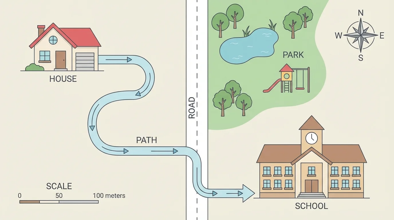
Maps can be small or big. A classroom map may show where the reading corner is. A town map may show streets and buildings. A world map shows many countries and oceans.
How maps help us describe places
Maps help us use location words. We can say the park is near the school, the store is across the street, or the playground is behind the library. A map helps us notice what is around a place and how places connect.
Later, when we talk about how to get somewhere, [Figure 2] stays helpful because it shows a path from one place to another.
[Figure 3] GPS is a tool that helps people know where they are and where they want to go. GPS can be in a car, a phone, or another device.
GPS can help someone find a store, a doctor, or a new house. It can show a route, which is the way to travel from one place to another. It can also tell when to turn left or right.
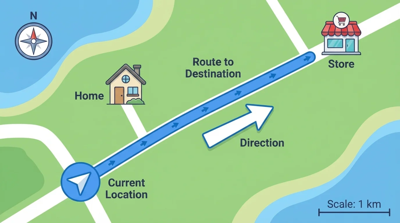
GPS is different from a globe and a map. A globe shows the whole Earth. A map shows a place on a flat surface. GPS helps people find their location and move from one place to another.
Example: Finding the park
Step 1: A family wants to go to the park, but they do not know the way.
Step 2: They use GPS on a phone.
Step 3: The GPS shows where they are now and which roads to follow.
The GPS helps them get to the park safely.
When people are in a new place, [Figure 3] shows why GPS is so useful: it helps them know where they are right now, not only what the place looks like.
We use geographic tools to describe places in simple ways. We can tell where a place is, what is near it, and how to get there. For example, we can say, "The school is near the park," or "My home is on a street near the store."
You already know many place words, such as near, far, left, right, up, and down. Geographic tools help us use those words to talk about real places.
A globe helps describe big places on Earth. A map helps describe places on paper or a screen. GPS helps describe where we are and the way to go. Each tool helps in a different way.
Some places are close to us, like our room, school, or playground. Some places are far away, like another state or another country. A map can show places near us or far away, and a globe helps us see faraway places on the whole Earth.
If you want to see where your classroom door is, a simple map works well. If you want to see where an ocean is, a globe works well. If you want to travel to your grandmother's house, GPS can help lead the way.
| Tool | What it shows | How it helps |
|---|---|---|
| Globe | The round Earth | Shows continents and oceans |
| Map | A flat picture of a place | Shows roads, buildings, and nearby places |
| GPS | Your location and route | Helps you find the way |
Table 1. A simple comparison of three geographic tools and how each one helps us describe places.
People use geographic tools every day. Families use maps and GPS when they travel. Teachers use globes and maps to teach about the world. Helpers such as firefighters and delivery drivers use geographic tools to get to the right place.
These tools also help us understand natural places and human places. They can show mountains, rivers, roads, homes, and cities. That means they help us learn about nature and about where people live and work.